Norwegian microsatellites make maritime traffic safer and can help us uncover illegal fishing, smuggling and environmental crime. This is the story of how they came to be.
Around the turn of the millennium, outer space was largely reserved for technological and economic superpowers. Large, traditional satellites cost billions of kroner. Even relatively small satellites could cost hundreds of millions of kroner.
Then something happened. In just a few years, Norway managed to develop its own, small, inexpensive and customised satellites in polar orbits. The first one was developed for a mere NOK 28 million, which garnered international attention.
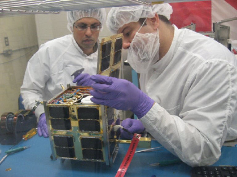
In 2010, the first Norwegian microsatellite was launched. AISSat-1 was to test new technology for ocean surveillance and had an expected lifespan of three years.
AISSat takes about one and a half hours to orbit the earth and passes the High North 15 times a day.
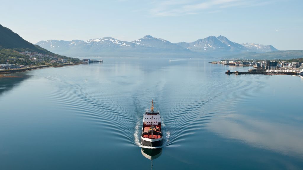
The satellite detects signals from ships in areas that cannot be seen by receivers on land.
The Norwegian Coastal Administration, Norwegian Armed Forces, Norwegian Directorate of Fisheries, Joint Rescue Coordination Centres and Norwegian Customs benefit from the data from the satellite.
The satellite continues to function, eight years after its expiry date and has now been joined by four other Norwegian microsatellites. More are on the way. But the Norwegian microsatellites got off to a difficult start.
The first project was slated
FFI’s work on developing a microsatellite for maritime surveillance began in 1998. In the same year, the Norwegian Armed Forces had begun using radar images from satellites in maritime surveillance. However, these data were purchased and the satellite was not under Norwegian control.
“We had seen that experimentation with microsatellites for communication and research had produced promising results internationally”, says Research Director Richard Olsen at FFI.
“We also knew that the Earth observation satellites at the time had limited coverage in the vast ocean areas Norway is to administer.”
Could Norway develop its own surveillance satellite that could detect marine radar signals and give the Norwegian Armed Forces better coverage in the High North? FFI launched a feasibility study. The project was given the name NSAT-1.
The feasibility study was presented in connection with the Chief of Defence’s Military Report in 2003. Despite the support of many in the Norwegian Armed Forces, the satellite was not recommended by the Chief of Defence. This was largely due to the price estimate of more than NOK 300 million. Already the following year, the Norwegian Government and Parliament (Storting) put a halt to the development of such a military satellite.
Such a capability is too costly for the establishment of national capabilities in a manner that satisfies operational needs. [...] Thus, no military satellite capability will be developed and all preparations relating to such a development are immediately terminated.
Propositions to the Storting (St.prp.) no. 42 – The further modernisation of the Norwegian Armed Forces 2005 – 2008.
“It was a slap in the face”, Richard Olsen recalls.
The solution became for FFI to continue on a civil path.
“While we were working on NSAT, it became clear that an automatic identification system (AID) would soon become mandatory for all larger vessels. Thus, we began assessing whether AIS messages could be detected from a small satellite in a low earth orbit in order to provide an overview of maritime traffic in Norwegian waters”.
On 5 April 2005, FFI’s Bjørn Narheim presented a proposal for an AIS satellite for the surveillance of the High North to the board of the Norwegian Space Agency.
The rest is history.

The Norwegian Space Agency granted funding for the development and testing of various solutions. Kongsberg Seatex developed a proposal for a programmable AIS receiver. In 2008, the Norwegian Space Agency, Norwegian Coastal Administration and FFI entered into a collaboration agreement to complete the development of the satellite. The budget was NOK 28 million, including launch and three years of operations.
On 8 July 2010, the satellite was launched from India. A few days later, it began delivering AIS messages.
Then Minister of Trade and Industry, Trond Giske, got carried away and was inspired by Neil Armstrong in connection with the launch.
“It’s one small satellite but one giant leap for Norwegian space travel”.
Built using ‘car parts’
“When the researchers at FFI proposed to make a small ocean surveillance satellite, we understood immediately that it was a very good idea”, says Terje Wahl, Department Director at the Norwegian Space Agency.
“The project showed us that it is possible to develop our own customised satellites at a manageable price.”
Microsatellites go in a low Earth orbit and operate in a less hostile environment – thereby avoiding the same strict space qualifications required for satellites that need to withstand high doses of radiation over long periods of time.
The low construction cost was, in part, due to the fact that AISSat1 was built using components from the ICT and automotive industries. These industries have strict quality requirements but large production volumes.
Microsatellites also use systems that are easier to test and troubleshoot. This saves both time and costs and results in more functional satellites.
“A paradigm shift”
Norway was early but not alone in launching microsatellites. Nowadays, the Norwegian Coastal Administration has access to data from approximately 100 AIS satellites through its international collaboration. The fact that we have our own satellites makes us a more attractive collaboration partner and allows us to exchange data with others.
The AID recipient Kongsberg Seatex has developed has become a commercial product that the enterprise offers on the global market.
“The development of these satellites has provided us with a national competence enhancement in the industry and at institutes like FFI”, posits Frank Udnæs, Department Director at the Norwegian Space Agency.
“Previously, Norwegian enterprises have developed individual components that have been used in space. Now we account for a larger share of the supply chain where we build and develop satellites ourselves. This has been a paradigm shift”.
Major potential for use in the Norwegian Armed Forces
The Norwegian Armed Forces uses satellite data for general surveillance and compiles AIS data with other information it obtains.
“The first two operating years with AIS were like turning on the light out in the Barents Sea and Norwegian Sea”, says Lieutenant Colonel Eirik Ludvigsen of the Norwegian Joint Headquarters (FOH).
“Since then we have launched additional commercial polar satellites but it is important for Norway that we have control of some satellites ourselves”. In a crisis, you never know if you will be able to receive data from commercial suppliers.
Ludvigsen has been one of the proponents of using satellites in the Norwegian Armed Forces. He believes microsatellites will have considerable utility value for the Norwegian Armed Forces’ operations in the future.
AIS is based on ships wanting to be seen. However, it is possible to turn off the AIS transponder or manipulate the signal it transmits. By equipping satellites with several types of sensors, we can gain a better overview and make it more difficult to trick the system.
“It will also mean a lot to establish coalitions of satellites that offer better coverage in time and space. This means that not only can we detect objects but also track them with satellites. Imagine that we can view live ‘footage’ from any part of the Norwegian waters we want, when we want, during a crisis”.
Will see ships that want to remain unseen
This year, things have in many ways come full circle. In April 2021, Norway launched NorSat-3, a new test satellite that is to spot those seeking to go undetected.
NorSat-3 has a navigation radar detector. This is the same type of sensor that was proposed on the NSAT-1 satellite project that was halted nearly 20 years ago. NorSat-3 detects signals from the radars ships use to navigate. The satellite is funded by the Norwegian Ministry of Defence (FD Space) and the Norwegian Space Agency.
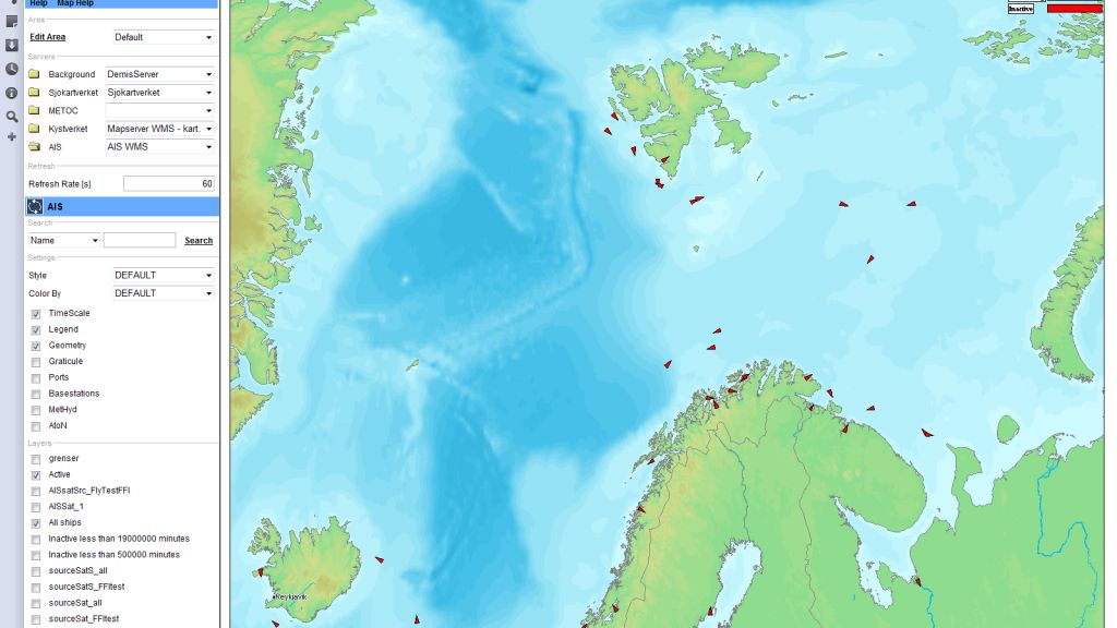
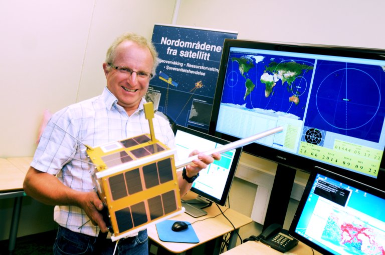
“Here you can see, right now, that NorSat-3 is above South America. It is heading north, right above the coast of Argentina”, says Researcher Reidar Lunde Lillestøl, pointing. On the monitor in front of him are the world oceans, full of red dots. These are AIS detections from Norwegian microsatellites.
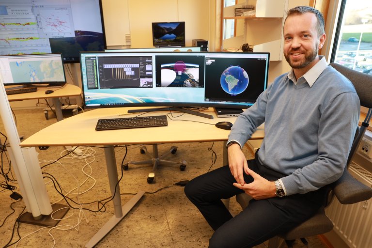
Lillestøl is sitting in FFI’s Mission Control Centre. In the months that have passed since NorSat-3 was launched, the team has been working on creating a user interface that makes it easy to control the satellite.
As opposed to the AIS satellites, which looks at vast areas directly below them, NorSat-3’s radar detector has a narrower scope. NorSat-3 needs to receive instructions for precisely where it should look at each placement.
“The radar detector only views a limited area of the ocean at any given time. There are also limitations as to how long it can search each day, because the sensors and the system uses so much power that it is unable to operate 24/7”.
This is what a flyover with the microsatellite NorSat-3 looks like.
The satellite has been instructed to detect marine radar signals in a specific area and its gaze remains fixed on that area throughout the passing.
Popular demand
In the BarentsWatch portal, the Norwegian Police, Norwegian Armed Forces, Norwegian Coastal Administration and Norwegian Customs receive AIS data regarding maritime traffic, gathered in one place.
The idea is that the users of BarentsWatch will be able to submit requests for where NorSat-3 should gather radar data.
If the Norwegian Armed Forces requires data from a specific area, NorSat-3 can deliver answers within a few hours. Over time, it may become relevant to have a constellation of NorSat-3 satellites, in order to enhance capabilities. Then we will be one step closer to Lieutenant Colonel Ludvigsen’s dream of live broadcasts from the ocean.
The future
Currently, FFI has approximately 20 full-time positions working on different satellite projects. They will have their hands full in the time to come.
In April 2022, Arc-Sat will be launched. It will improve military communication in the High North.
Half a year later, MilSpace will be put into orbit. This is a collaboration between Norway and the Netherlands. Twin satellites will go in a polar orbit and detect and triangulate radar signals from both sea and land.
FFI is also working on NorSat-4, a satellite that will be equipped with an electro-optical camera which is optimised for finding ships. By compiling AIS, radar data and images, we gain a better overview and it will become easier to find ships that want to go undetected.
Mega constellations
Richard Olsen believes it will become important to follow developments internationally, going forward.
“Some commercial actors, including OneWeb and SpaceX, are ambitious and are looking at mega constellations involving more than 1000 satellites. This will impact both civil and military thinking regarding the use of satellites”, says Richard Olsen.
“Our allies are also looking into the possibility of using small satellites that are cheaper and faster to develop. An important question going forward is how we can make such satellite systems robust against jamming and cyber-attacks”, says Olsen.
“In many ways, we have been in the right place at the right time. We already have a community that is working on this technology. We can point to an ability to execute that is envied by our major collaboration partners and we have shown that we can develop concepts that have genuine utility value.